Drone Operations Management
Real-time visualization and tracking for multi-drone operations
Book a DemoSee your entire operation at a glance
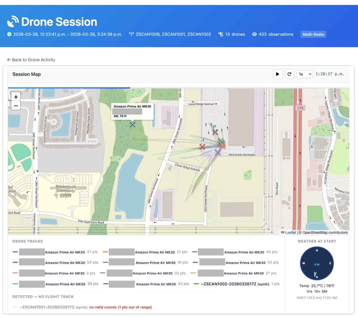
When 13 drones operate in the same airspace, you need more than individual flight tracks
Multi-Source Tracking
Aggregate results from multiple base stations and Remote ID receivers into a single unified view of your operation
Real-Time Updates
Latencies as low as 50 milliseconds from location receipt to display update, powered by WebSocket streaming
Collision Detection Coming Soon
Proximity alerts when aircraft approach each other, with configurable distance thresholds. Currently in development.
Purpose-Built for Drone Operators
From live monitoring to post-flight review, SkyZero covers the full operations lifecycle
Multi-Aircraft Visualization
Track every drone in your operation simultaneously on a single map:
- Color-coded tracks: Instantly distinguish between aircraft with unique colors per drone
- In-flight vs ground: See which drones are airborne and which are on the ground at a glance
- Operator locations: Track ground control station positions alongside aircraft
- Weather overlay: Live METAR conditions at the operation area
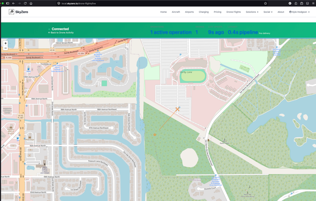
Real-Time Streaming
Sub-second latency from detection to display:
- WebSocket push: Updates stream directly to your browser, no polling required
- IoT integration: Connects to Zing Drones and other Remote ID platforms via cloud queuing
- Latency monitoring: On-screen display shows actual end-to-end latency
- Scalable architecture: AWS-backed pipeline handles high-frequency position updates
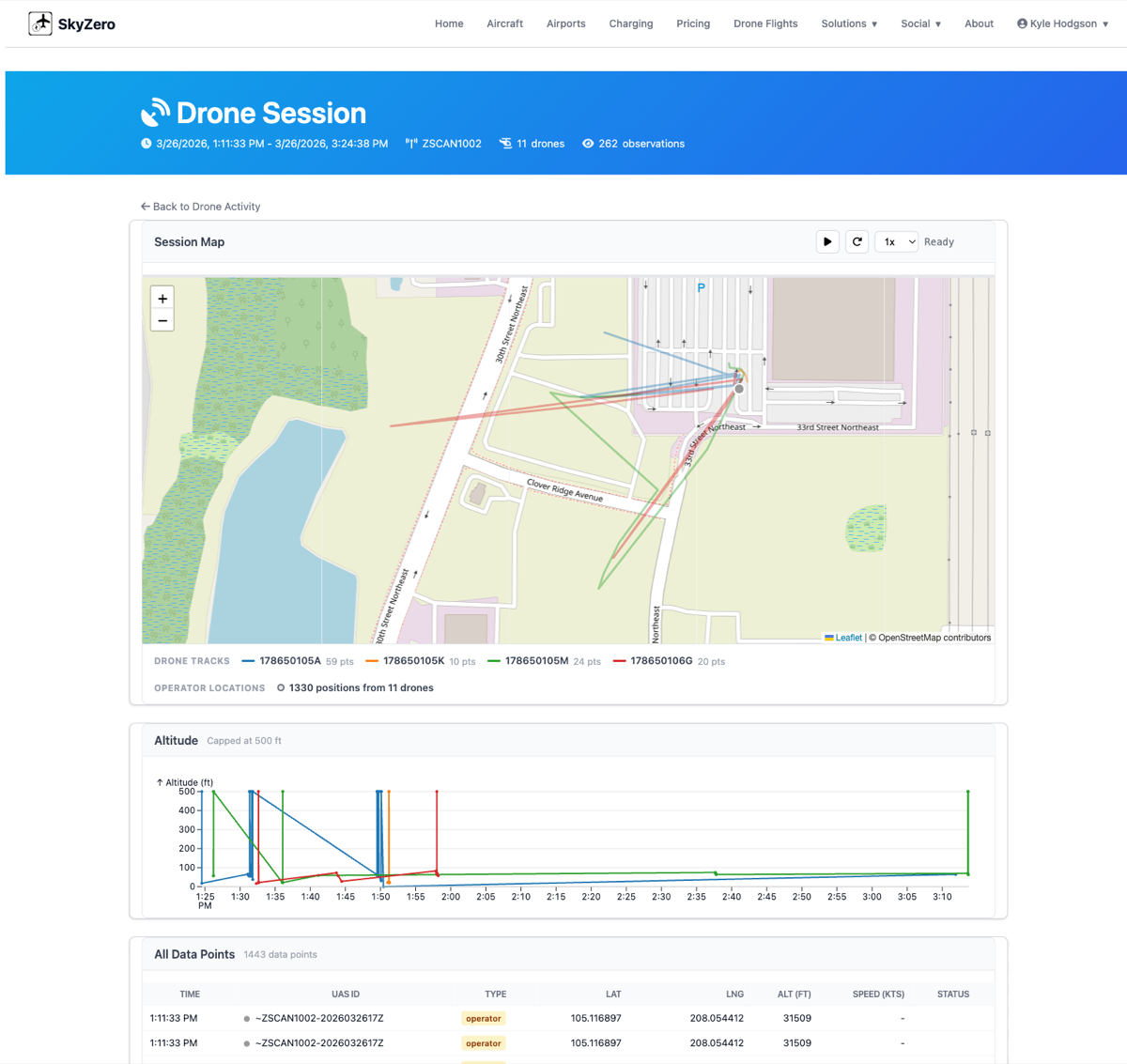
Session Review & Analysis
Comprehensive post-flight analysis for every operation:
- Flight path replay: Animated playback of drone movements on the map
- Altitude profiling: Time-series altitude charts for each aircraft in the session
- Raw data access: Full observation table with timestamps, positions, altitude, speed, and status
- Multi-drone sessions: Automatically groups concurrent operations into sessions
How It Works
Connect Your Hardware
Integrate your Remote ID receivers, base stations, or drone telemetry systems with our cloud pipeline
Stream Data
Position reports flow through AWS IoT to SkyZero in real-time, with automatic session grouping
Visualize Operations
Watch your fleet live on a map, or review past sessions with full playback and altitude profiling
Analyze & Report
Access altitude profiles, flight duration metrics, and exportable data for compliance and review
Built for Complex Operations
Whether you're managing a test fleet or running commercial drone services
Flight Testing
Monitor test flights in real-time with full telemetry recording. Review altitude profiles and flight paths post-session for engineering analysis.
Urban Operations
Manage multi-drone delivery or inspection operations in congested airspace with real-time multi-aircraft visualization.
Detection Networks
Aggregate feeds from multiple base stations to build a complete picture of drone activity in your airspace, including non-conforming aircraft.
Integration Partners
SkyZero integrates with leading drone detection and Remote ID platforms
"Combined with Zing's base station solution — which detects both conforming and non-conforming drones — SkyZero enables fine-grained operations tracking with real-time visualization."Zing Drones & SkyZero integration
Ready to See Your Operations in Real-Time?
Schedule a demo to see the drone operations visualizer in action
Custom integrations available for any Remote ID or telemetry platform