Pick your aircraft and a departure field. SkyZero draws your range over every
airport we track, tells you which chargers are free right now, and gives you the
weather to fly it.
Cancel anytime. Works on the web and in the AirCharging app.
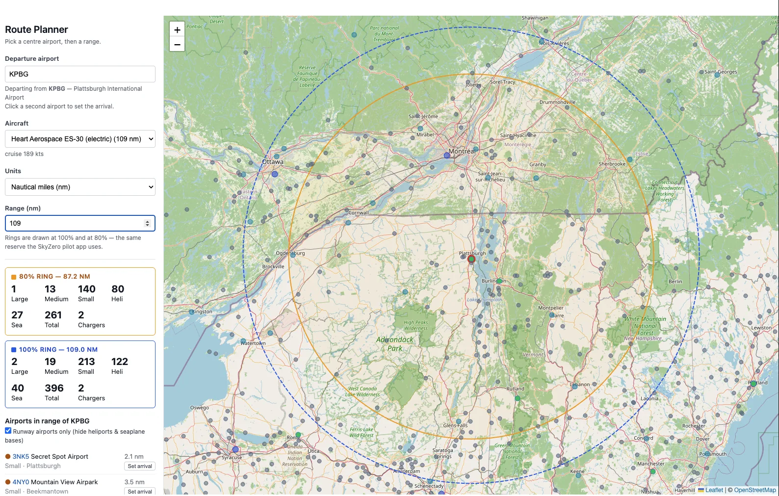
Route Planner — ES-30 out of KPBG. 396 airports inside full range, 261 inside reserve.
The reserve ring
Rings at 100 and 80%
Book range assumes a new battery, still air and no diversion. So the planner
draws both: the full ring, and a conservative one at 80% — the
same reserve the AirCharging app uses in the cockpit.
Full range
109.0 nm
80% reserve
87.2 nm
Each ring carries its own count of the large, medium and small fields inside it
— and how many of those have a charger.
On the web
Plan the whole trip
Chain legs together and the planner measures each one — distance, true
track, longest leg, and a plain verdict when a leg runs past your range.
Filter out heliports and seaplane bases, switch between nm, km and sm.
Share a plan as a link. Anyone can open it, no account needed.
In the aircraft
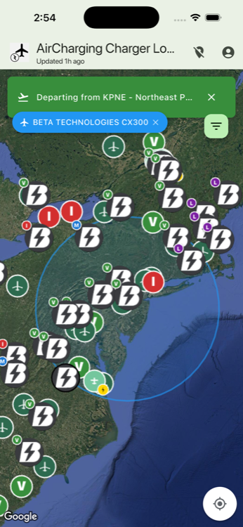
Range you can see on the map
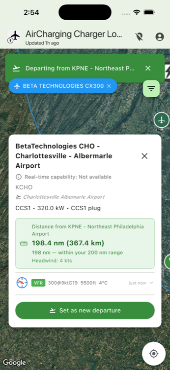
The AirCharging app puts your reserve ring over the live map. Tap any field for
the distance, whether it is inside your range, and the headwind or tailwind
component on that course from the current METAR.
Right now
Which chargers are busy
Live status from AeroVolt and NRG2FLY, down to
the individual plug and the kW it is drawing. Refreshed every five minutes, and
every 30 seconds on the map in front of you.
Available
In use
Offline
Also in Flight Planning
Weather for any airport
Current METAR and TAF, with VFR / MVFR / IFR / LIFR flight categories painted straight onto the map.
Aircraft activity alerts
Watch up to 25 tail numbers and get an email the moment one of them goes active.
Full aircraft history
Open any aircraft for its 90-day activity calendar and complete, sortable flight history.